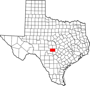
Gillespie County Water Wells
The Hill Country Underground Conservation District “District” began registering new water wells drilled in late 1989 and in 1999 began issuing permits for permitted wells (i.e. commercial, irrigation, municipal) as well.
After the District was created District personnel contacted local drillers to get copies of the driller’s logs for Gillespie County that were drilled prior to the establishment of the District. It is an on-going process locating these wells. The District is not in possession of all the driller’s log prior to the Districts creation as some driller were no longer in business or the drilling company was not from the surrounding area. In addition, wells drilled prior to 1965 were not required to file driller’s log with the state.
Please note the District will continue to update the map on a regular basis as new wells are drilled and/or existing wells (pre-District) are located. Contact the District if you find any errors (i.e. miss located). In addition, there are properties that have a well but the District does not show one, however if you can provide who the owner was at the time the well was drilled we can look up to see if we have the well log just not located.
Well Types:
- Registered Wells – wells used solely for domestic and livestock (Prefixes with ER, R, KK, OW, WT)
- Permitted Wells – wells used for commercial, irrigation or municipal purposes which are subject to the District requirements regarding spacing and production limits (Prefix with P * i.e. PI-00001)
- Historic Wells – wells that were in existence prior to November of 1999 that were used for commercial, irrigation or municipal purposes are exempt from current permitting requirements (Prefix with G * i.e. GI-00001)
Registered wells with prefixes “KK, OW, and WT” the District does not have a driller’s log for that particular well along with some permitted and historic wells.
By clicking each marker it will provide you a synopsis of the well. If you need a copy of the well log, please contact us with the HCUWCD # and we can email you the well log.
Disclaimer:
The information found is compiled and made available as public service by the District. This product is for informational purposes only and may not have been prepared for or be suitable for legal, engineering, or surveying purposes. It does not represent an on-the-ground survey and represents only the approximate relative location of property boundaries; and
The District makes no warranty as to the accuracy, reliability, or completeness of the information and are not responsible for any errors or omissions or for results obtained from the use of the information. The District expressly disclaim any and all liability in connection herewith. Use of the information is the sole responsibility of the user.
