Local Drought Index
The Hill Country Underground Water Conservation District adopted a Drought Management Plan in December 2004 and was amended in March 2009 and May 2014. In it, a local drought index for Gillespie County was developed, based on multiple local drought sensitive parameters. These include:
- the water levels from two Ellenburger aquifer wells located in areas where heavy pumpage occurs for municipal and irrigation demands;
- the Pedernales flow data from the Lower Colorado River Authority (LCRA) gauge located on Highway 87 South;
- the previous ten month cumulative rainfall amounts as recorded at Lady Bird Johnson Park; and
- the Palmer Drought Severity Index for the Edwards Plateau.
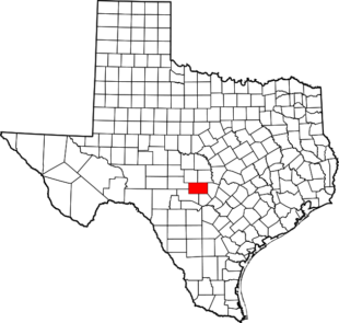
The local drought index for Gillespie County, Texas as of February 1, 2025 is -3.61, a severe drought stage.

The trigger conditions that implement the plan are based on these local drought indices, however the Board of Directors or its designee may choose to use the local Drought Index or any other drought indices (i.e. PHDI, PDSI, and National Drought Mitigation Center) which the District believes most accurately reflects drought conditions in Gillespie County. The Hill Country Underground Water Conservation District may make a Critical Groundwater Depletion Designation at any time when local conditions warrant a designation. Once the District makes a Critical Groundwater Depletion Designation, then all permitted wells in Gillespie County, including all grandfathered wells, must reduce production to prescribed levels.
Drought Level Water Reduction
Stage 1 – Mild 5% reduction in average daily water demand
10% reduction in maximum daily water demand
Stage 2- Moderate 10% reduction in average daily water demand
20% reduction in maximum daily water demand
Stage 3 – Severe 15% reduction in average daily water demand
25% reduction in maximum daily water demand
Stage 4 – Critical 20% reduction in average daily water demand
40% reduction in maximum daily water demand
Stage 5 -Emergency 30% reduction in average daily water demand
50% reduction in maximum daily water demand
This reduction would pertain to all permitted wells that are used for municipal, irrigation and commercial purposes. They would not pertain to domestic or livestock wells which are exempt.
We should all begin now to implement water conservation practices to prolong or avoid a Critical Groundwater Depletion Designation. We all have some control over this due to the fact that the local drought index is based largely on aquifer water levels, which respond directly to how much water is being pumped. If less water is being used for lawn and landscape irrigation, then less water will be pumped and aquifer water levels will not decline, which will have a positive impact on the calculation of the local drought index. As a result we all have a say as to whether the District is compelled to make a Critical Groundwater Depletion Designation, with the associated water rationing and reduction requirements that will come with such a designation.
A link to the forecast by the National Oceanic and Atmospheric Administration (NOAA) of the El Niño – La Niña conditions in the Pacific Ocean is below.
http://www.cpc.ncep.noaa.gov/products/CDB/Forecast/figf4.shtml
